All volumes from 1947 onwards are available as PDF files. They may be downloaded for research and Abernethy Round Tower, Balvenie Castle, Castle Borve.
528 KB – 278 Pages
PAGE – 4 ============
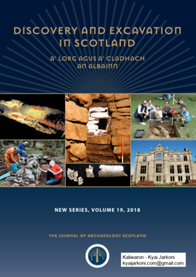
2 A™ LORG AGUS A™ CLADHACH AN ALBAINN Archaeology Scotland is a voluntary membership organisation, which works to secure the archaeological heritage of Scotland for its people through education, promotion and support: Ł education, both formal and informal, concerning Scotland™s archaeological heritage Ł promotion of the conservation, management, understanding and enjoyment of, and access to, Scotland™s archaeological heritageŁ support through the provision of advice, guidance, resources and information related to archaeology in Scotland Our visionArchaeology Scotland is the leading independent charity working to inspire people to discover, explore, care for and enjoy Scotland™s archaeological heritage. Our mission–to inspire the discovery, exploration, stewardship and enjoyment of Scotland™s past. Membership of Archaeology Scotland Membership is open to all individuals, local societies and organisations with an interest in Scottish archaeology. Membership bene˜ts and services include access to a network of archaeological information on Scotland and the UK, three newsletters a year, the annual edition of the journal Discovery and excavation in Scotland, and the opportunity to attend Archaeology Scotland™s annual Summer School and the Archaeological Research in Progress conference. Further information and an application form may be obtained from Archaeology Scotland Email info@archaeologyscotland.org.uk Website www.archaeologyscotland.org.uk A™ lorg agus a™ cladhach an Albainn The Gaelic translation of Discovery and excavation in Scotland was supplied by Margaret MacIver, Lecturer in Gaelic and Education, and Professor Colm O™Boyle, Emeritus Professor, both at the Celtic, School of Language and Literature, University of Aberdeen. Cover images 1) Inchnacardoch Bridge Œ A laser scan survey of a bridge, part of the 18 th-century road network. Copyright: FCS (see page 108) 2) Bede House Œ Recording the articulation of the yard dyke with later plantation dyke. Copyright: Iain Ralston (see page 19) 3) Clachtoll Broch Œ Guard cell at Clachtoll Broch, after excavation. Copyright: AOC Archaeology Group (see page 107) 4) Lephin Œ Fragments of a decorated composite bone comb. Copyright: Argyll Archaeology (see page 44) 5) Crathes Castle Estate Œ Proud participants of the NTS Crathes Big Dig show off their trench. Copyright: National Trust for Scotland (see page 10) 6) Ury House – South façade Ury House west end; facing NNW. Copyright: Cameron Archaeology (see page 14) Back cover: 7) Tomatin to Boat of Garten Œ A total of 47 sites from a range of time periods were recorded during this survey, including a military road bridge and post-medieval farmsteads. Copyright: AOC Archaeology Group (see page 103) Price £25Published, designed and produced by Cathedral Communications Ltd, High Street, Tisbury, Wiltshire, England SP3 6HA © Archaeology Scotland 2019 ISSN 0419-411X 1243567
PAGE – 5 ============
DISCOVERY AND EXCAVATION IN SCOTLAND 3CONTENTS EDITORIAL POLICY 4ACKNOWLEDGEMENTS 4NOTES FOR CONTRIBUTORS ..5ARCHAEOLOGICAL CONTRIBUTIONS ..8HISTORIC ENVIRONMENT SCOTLAND ..209SCOTTISH ARCHAEOLOGICAL RADIOCARBON DATES ASSOCIATED WITH THE NATIONAL MUSEUMS SCOTLAND, 2017/18 217RADIOCARBON DATES FOR GROOVED WARE POTTERY FROM MAINLAND SCOTLAND ARISING FROM THE PROJECT TRACING THE LINES: UNCOVERING GROOVED WARE TRAJECTORIES IN NEOLITHIC SCOTLAND 222RADIOCARBON DATES FOR NEOLITHIC ISLET SITES ON THE ISLE OF LEWIS ..226A SUMMARY ROUND -UP LIST OF SCOTTISH ARCHAEOLOGICAL HUMAN REMAINS THAT HAVE BEEN SAMPLED/ANALYSED FOR DNA AS OF JANUARY 2019 ..227CURRENT POST -GRADUATE SCOTTISH ARCHAEOLOGICAL RESEARCH IN THE UK 251LOCAL AUTHORITY ARCHAEOLOGICAL ADVISORS AND THEIR AREAS OF RESPONSIBILITY .253LIST OF CONTRIBUTORS ..255LIST OF ABBREVIATIONS ..260INDEX ..261
PAGE – 6 ============
4 A™ LORG AGUS A™ CLADHACH AN ALBAINN EDITORIAL POLICY Since the ˜rst volume in 1947 Discovery and excavation in Scotland ( DES) has played a vitally important role in Scottish archaeology. Each new issue offers a simple way to keep up to date with current work in the ˜eld, and the back issues provide a research tool for anyone seeking information about the archaeology of Scotland. The full run of DES is now available digitally, with the exception of the most recent two volumes. These are available in print form to members of Archaeology Scotland. All volumes from 1947 onwards are available as PDF ˜les. They may be downloaded for research and teaching purposes but must not be resold or made available on any other web site or any other medium with or without charge, unless with the prior written consent of Archaeology Scotland and the relevant copyright holders. The digital archive may be accessed via a link on the Archaeology Scotland website. DES is not intended as a medium for ˜nal publication. It is a reference work, an annual summary of activity in technical form. A fuller account will eventually appear in print elsewhere, and/or further detailed records will be deposited with Historic Environment Scotland and in the appropriate museum service. It is a condition of Historic Environment Scotland funding that entries should be supplied for publication in DES.Archaeology Scotland publishes DES as a service to its members and to archaeology generally. It is aimed at a readership with a specialist interest in archaeology and welcomes contributions from all sectors of the archaeological community. Financial support is received from various bodies for entries relating to their work, and further contributions are received for reports on developer- funded projects. DES aims to provide a rapid, comprehensive summary of all archaeological work undertaken in Scotland each year by the end of May in the succeeding year. This imposes a very tight timescale on the production process. These considerations underlie and constrain the editorial policy re˚ected in the notes for contributors below. It seeks to balance maximum information value and accuracy with speed of production and minimum cost. It is divided into two sections: notes for contributors on the format and deadlines for submissions, and a section on conventions, arranged in alphabetical order. ACKNOWLEDGEMENTS I am grateful to Jack Stevenson for his support during the production of this volume and in particular his assistance with the proof-reading. Special thanks to Jennifer Shore for undertaking ˜nal checks. My thanks also go to Gordon˛Sorensen and Helen Sawyer at Cathedral Communications Ltd for all their hard work and to Susan Vaughan for compiling the index. The assistance I received from the people mentioned above undoubtedly immensely improved DES.Thanks are due to the Stationery Of˜ce Ltd Cartographic Centre for the Local Authority map. Archaeology Scotland is in receipt of an award from Historic Environment Scotland. Archaeology Scotland wishes to acknowledge the following bodies for generous ˜nancial assistance in respect of the reports relating to their particular contributions to this volume: Ł Forestry Commission Scotland Ł Historic Environment Scotland Paula Milburn, Archaeology Scotland NEW SERIES, VOLUME 19, 2018 THE J OURNAL OF ARCHAEOLOGY SC OTLAND
PAGE – 8 ============
6 A™ LORG AGUS A™ CLADHACH AN ALBAINN Three linear banks that lay outside the limits of the previous work undertaken by the RCAHMS (survey DC17478/PO) were surveyed. Archive and report: RCAHMS (intended). Report: Highland HER Funder: Entec UK [Contact details for organisation / individual name Œ for contributors list] 1.7 Format for editors [Local authority][Parish] Site nameType(s) of project Name of contributor(s) Name of organisation National Grid Reference (2 letters, 8 or 10 ˜gures) [space] [Report] [tab] second and subsequent paragraphs Location of archive and/or report [no full point] Funder: [no full point] 2 CONVENTIONS 2.1 Abbreviations and acronyms Ł Do not punctuate abbreviations or acronyms, eg RCAHMS, National Museums Scotland, mm, m, Fig Ł Use N, S, E, W, NE, SSE, EŒW, and NS for cardinal points and directions. Spell out northwards, southern etc in full. 2.2 Bibliographic references Ł It will not normally be necessary to provide references for entries in the DES county list.Ł References to previous DES entries for the same site should be in the form DES 2001, 92Œ93. Ł For other references follow the Harvard system. Cite the reference in the text as the author™s name and the year of publication, with page and illustration references. Provide a full list of references in alphabetical order at the end of the entry. Use the CBA journal abbreviations. Ł Take the title from the title page, not from the spine or elsewhere on the cover. The title should be transcribed exactly as to wording and spelling but not necessarily as to punctuation and capitalisation. This means that except for proper names, only the ˜rst word of a title should be capitalised and no full stop is necessary at the end of the title. 2.3 Dates Ł Cite dates as 30 July 1893. Ł Use the form 5th century, 3 rd millennium.Ł Note that dates used as adjectives are hyphenated; 5th-millennium date, 18 th-century moulding.Ł Use 1590s, 1930s. Ł Note the order 49 BC, but AD 1952. Ł Elision of dates should be to the shortest form consistent with clarity, eg 5Œ6 July, 1745Œ7. 2.4 Geographical references Ł To allow sites/˜nds to be located to the highest possible degree of accuracy National Grid references (NGRs) should be given as two letters and at least eight ˜gures. Ten ˜gure NGRs would also be most welcome. Ł Exceptions are treasure trove locations where the submitting body feels that a more ambiguous location is appropriate, or completed work where the locational information has already been submitted to DES.Ł Use current rather than historic local authority divisions (see map in this volume). 2.5 Italics Ł Use italics for the titles of books and journals, eg Discovery and excavation in Scotland, DES, Proc Soc Ant Scot.Ł Use italics for foreign words and quotations, eg c (for circa ), terminus ante quem, honi soit qui mal y pense. 2.6 Numbers and measurements Ł Spell out the numbers from one to ten except in measurements. Numbers 11 and above should be numerals except where the context makes this awkward (eg at the beginning of a sentence).Ł Figures between 1000 and 9999 do not require a comma. Ł Where numbers appear in a sequence, use numerals, eg of 100 trenches, 74 produced white gritty ware. Ł Elision of numbers should be to the shortest form consistent with clarity, eg 254Œ8, 116Œ18, 196Œ203. Ł Cite measurements in kilometres (km), metres (m) or millimetres (mm). Use the unit that is appropriate for the accuracy of the measurement. Ł Do not use cm as they are not an SI measurement. Ł Do not leave a space between the number and the unit of measurement. Ł In a series of measurements using the same unit only the last measurement needs to be followed by the unit, eg 34 x 67 x 83mm.Ł The accuracy of measurements and the units used to describe them will not be comprehensively checked, and the responsibility for ensuring their accuracy rests with the contributor. 2.7 Quotations Ł Short quotations should be enclosed in single quotation marks. Ł Lengthy quotations (more than ˜ve lines) should be indented, beginning a fresh line, and should not have quotation marks. 2.8 Spelling Ł Spelling should follow the Concise Oxford Dictionary, preferring the ˜rst variants where offered. Ł Note the preferred spellings of the following words and phrases: 1st Edition OSannexe (noun) artefactcup mark databledry stone gazetteerground-breaking groundwork gully hollow-way hut circle land usemedieval metal detectingmillennium penannularplanticrub ploughsoilposthole rig and furrow ring ditch roundhouse samian viewshed walkover wind farm2.9 Style Ł Contributions should be brief statements of work undertaken. Ł Survey information should be summarised. Ł Write simply and clearly. Ł Try to be interesting. Ł Avoid the use of the passive.
PAGE – 10 ============
8 A™ LORG AGUS A™ CLADHACH AN ALBAINN ABERDEEN CITY NATIONAL AND REGIONAL SURVEYS Scottish Medieval Castles and Chapels C14˜Project Surveys Mark Thacker Œ University of Stirling This project is investigating the palaeoenvironmental potential of Scottish medieval building materials. The project, which is running from August 2016 Œ July 2019, is undertaking non-intrusive archaeological surveys of surviving (and generally upstanding) medieval and later buildings across Scotland, to characterise changing constructional mortar compositions in˜situ . Further lab-based geoarchaeological, archaeobotanical and radiocarbon analysis has also been undertaken on material samples removed from particular case study sites, in order to re˜ne characterisations of material sources and inform constructional chronologies. Case study sites currently under investigation include: Abernethy Round Tower, Balvenie˛Castle, Castle˛Borve Benbecula, Castle Roy, Castle Sween, Duffus Castle, Dunstaffnage Castle, Hailes Castle, Kincardine Castle, Kinclaven Castle, Lismore Cathedral, Lochindorb Castle, Rothes Castle, and Spynie Palace. Information relating to the individual sites may be found within this edition of DES.Archive: NRHE (intended) Funder: University of Stirling and Historic Environment Scotland ABERDEEN CITY Aberdeen Haudagain Roundabout, Aberdeen Watching brief Eduardo Pérez-Fernández and Christine Rennie Œ GUARD Archaeology Ltd NJ 912 090 A watching brief was carried out, 9Œ17 July 2018, during the excavation of 23 geotechnical test pits. No ˜nds or features of archaeological signi˜cance were recorded. Archive: NRHE (intended) Funder: ERS Ltd 112 High Street, Aberdeen Watching brief Alison Cameron Œ Cameron Archaeology NJ 93932 08474 A photographic survey was carried out of the former public toilets after demolition of three of the four walls. A watching brief was carried out during the soil strip under the building and a pit and posthole were excavated. The pit was modern but the posthole contained sherds of medieval pottery forming the base of a late medieval locally- made jug.Archive: NRHE Funder: Private individual Marischal Square, Aberdeen Watching brief Alison Cameron and Robert Lenfert Œ Cameron Archaeology NJ 94198 06385 A number of watching briefs were carried out, 22 August 2014 Œ 23 February 2018 during various works associated with a new shopping and of˜ce complex. In general the ground was very disturbed, but medieval pottery and butchered mammal bone was recovered from test pits in Broad Street which had probably been disturbed from a nearby midden. No ˜nds were recovered in situ and features dated to the 19th century or later. Archive: NRHE Funder: Muse Developments St Andrew Building, Aberdeen Standing building recording Hilary Murray and Charlie Murray Œ Murray Archaeological Services Ltd NJ 93803 06573 A standing building survey was undertaken on 12 January 2018 of the St Andrew Building. The building, completed c1920, was the Provincial Teacher Training College, designed by the architect John Alexander Ogg Allan. It has recently been used as part of the campus of Robert Gordon™s University so few original internal features remained. The basement had been used as an Air Raid shelter in WW2 and retained painted Red Cross signs and muster point numbers. Archive: Aberdeen HER and NRHE Funder: Sandman Hotel Group (UK) Ltd St Machar™s Cathedral Watching brief Robert Lenfert Œ Cameron Archaeology NJ 93914 08778 A watching brief was carried out on 23Œ24 May 2018 during the removal of pews. A wall was uncovered and recorded, but its position suggested that it was of post- medieval date. Archive: NRHE Funder: Cathedral Church of St Machar Newhills Craibstone South Evaluation Stuart Wilson Œ AOC Archaeology Group NJ 87061 10677 (centred on) An evaluation was undertaken, 5Œ12 November 2018, in advance of Phase 2 of a residential development. The work revealed a shallow topsoil that had been greatly affected by plough scars and other farming activities. Archive: NRHE (intended) Funder: Cala Homes Ltd Rowett South Standing building recording and evaluation Alison Cameron and Robert Lenfert Œ Cameron Archaeology NJ 87745 10336 A Level 2 standing building survey was carried out, 20 December 2017 Œ 25 May 2018, prior to demolition of farm buildings at Eastside of Craibstone for new housing. An 8% evaluation was carried out in the surrounding ˜elds, and ˜ve truncated postholes or pits were recorded in three areas. A monitored soil strip will follow. Archive: NRHE Funder: Bancon Peterculter West Access Road, Countesswells Evaluation Maureen C Kilpatrick Œ GUARD Archaeology Ltd NJ 87472 04755 A 7% trial trenching evaluation was carried out, 12Œ19 February 2018, in advance of the construction of a road. The excavation of 34 trenches, each 2m wide, covering an area of 3310m² revealed no ˜nds or features of archaeological signi˜cance. Archive: NRHE (intended) Funder: Stewart Milne Homes North Lasts Quarry, Peterculter Evaluation and watching brief Hilary Murray and Charlie Murray Œ Murray Archaeological Services Ltd
PAGE – 11 ============
DISCOVERY AND EXCAVATION IN SCOTLAND 9ABERDEENSHIRENJ 82440 04079 In the light of proposals to extend activities at the quarry an evaluation was carried out on 21 November 2017 and a watching brief on 25 June 2018. Both proved negative with no evidence of archaeological features or ˜nds. Archive: Aberdeen HER and NRHE Funder: Leiths Scotland Ltd ABERDEEN/ABERDEENSHIRE Peterculter/Banchory-Ternan/Drumoak Grieve Collection Cataloguing Caroline Wickham-Jones and Torben Bjarke Ballin NO 75050 96000 Œ Nethermills Farm NM1, NO 75880 96160 Œ Nethermills Farm NM4, NO 79550 98180 Œ East Park, NO˛80350 98500 Œ Dalmaik Farm, NO 81050 98500 Œ Dalmaik Hatchery, NO 74730 95950 Œ Milton Cottage, NO 71800 96200 Œ Birkwood East, NJ 85700 00600 Œ Maryculter Bridge Cataloguing, June 2018 Œ March 2019, of an existing collection of lithics from a number of sites resulting from ˜eldwalking along the River Dee undertaken by Dr Grieve in the 1970s has revealed evidence of activity from the Palaeolithic to the Bronze Age. Archive: Contributors (currently), Aberdeenshire Council and HRHE (intended) Funder: Society of Antiquaries of London, Society of Antiquaries of Scotland, Marc Fitch Fund, and Aberdeenshire Council ABERDEENSHIREAlvah Mountblairy Metal detector ˜nd Alice Blackwell Œ National Museums Scotland NJ 69 54 A medieval short cross penny, folded in half. Claimed as Treasure Trove (TT137/17) and allocated to Aberdeen˜University Museums Auchindoir and Kearn Cairnmore, Aberdeenshire Œ Northern Picts Project Excavation Gordon Noble, Edouard Masson-MacLean and Je˚ Oliver Œ University of Aberdeen NJ 5035 2494 A four day evaluation was carried out, 28˛September Œ 1 October 2018, to further elucidate the form, character and chronology of Cairnmore Fort Œ dated to the 5 th to 6th century AD by Murray Cook in 2011. Seven trenches were laid out. Trenches 1, 2 and 3 targeted the inner rampart exposing the core of the rampart, a putative wall face and a charcoal spread. Trench 4 was located directly W of Trench 5 but did not reveal any archaeological features. Trench 5 was located in the SE area of the site, over the inner rampart and possible entrance. A 6m stretch of the rampart was revealed showing that the rampart survived to 3m wide with a tumble of stone extending eastwards on the downslope side. A shallow pit or ditch terminal was also uncovered. Trench 6 was laid out over the outer rampart revealing an extensive spread of stones extending inwards from the rampart edge. The core of the rampart could not be clearly identi˜ed and there was a lack of de˜nitive wall facing. A˛shallow pit or truncated posthole was identi˜ed lying outside of the rampart wall. Slag and a possible gaming piece were recovered from the rampart core. Trench 7 was located in the interior of the fort and revealed the remains of a structure including a stone-built hearth and stone post-pad as well as an extensive spread of large stones. The hearth contained a least one ˜ll.There was no clear evidence of edges to the structure. Another spread of large stones was located in the SW corner of the trench but it could not be established if it was associated with these internal features or a different structure beyond the excavated area. A large spread of small stones exposed in various sondages was interpreted as a putative occupational surface and may be key to establishing the layout to the internal structure. A ˚int blade and a gaming piece were recovered from Trench 7. Radiocarbon dating will clarify the chronology of the rampart and the internal structure. Archive: University of Aberdeen Funder: University of Aberdeen and Leverhulme Trust Druminnor Castle Excavation Colin Shepherd Œ Bennachie Landscapes Fieldwork Group NJ 5131 2642 A seventh season of work was undertaken, June Œ October 2018, at Druminnor Castle. This season has helped to clarify the plan and chronological development of buildings constructed in the lower court of the late 15 th-/early 16th-century castle enclosure. Two structures were built against the inner side of the N Barmkin wall with the NE corner of one forming the corner of the castle complex as shown on an 18 th-century estate plan. The excavations appear to demonstrate the reasonable accuracy of that plan. Radiocarbon dating has provided a sequence of dates running from the second quarter of the 15th century through to the middle of the 17th century. The larger (western) building appears to be later than the one in the corner and may have replaced an earlier structure that would have been aligned with the corner of the smaller building. The evidence for the destruction of the earlier structure was sealed beneath two later ˚oor surfaces and overlay a probable third ˚oor. The W wall of the smaller (corner) building had been rebuilt after subsiding into an underlying ‚ditch-like™ feature. The purpose of that feature is still debatable (but, see below). A receipt from 1440 for building works done on the existing S range of the castle coincides with a closely dated bone from on top of the natural in the area of the lower court. This suggests the ˜rst half of the 15 th century was a period of massive recon˜guration at Druminnor. A royal licence to build and fortify ‚Drymynour™ was granted in 1456, along with the right to ‚circumvallate it with ditches™. The lower court itself appears to have been added a couple of generations later, perhaps around 1500. In Trench 11, on another part of the site, earlier, tentative suggestions of a possible ‚rampart™ appear to have been unfounded. However, the feature that gave rise to that speculation may perhaps be seen to have formed the outermost deposit of a ‚terrace-like™ structure. This awaits further corroboration next year. Most perplexing was the recognition of a massive, rock-cut ‚cavity™ that had been sealed by subsequent deposits, including the speculative ‚terrace™. However, it is still questionable whether this feature is man-made or geological and further work needs to be carried out to test those suggestions. As ever, grateful thanks to Alex Forbes for permission to continue work on his lawns and for his endless knowledge of things ‚Forbes™. Also, many thanks to the volunteers
528 KB – 278 Pages