tone are up t he Lucayan limestone aquifer ha. Ground water may be brackish to saline in areas surrounding creeks. Map Unit 1 comprises over a third of the
114 pages
Missing: paymentsa balance
107 KB – 114 Pages
PAGE – 1 ============
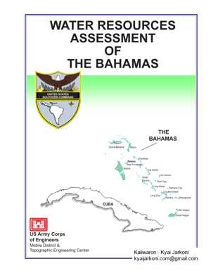
CUBAGrand BahamaAbacoEleutheraCat IslandRum CaySan SalvadorLong IslandGreatExumaAndrosNew ProvidenceCrooked IslandAcklinsMayaguanaGreat InaguaLittle InaguaSamana CayLong CayFreeportNassauWATER RESOURCES ASSESSMENTOFTHE BAHAMASUS Army Corps of EngineersMobile District & Topographic Engineering Center THE BAHAMASUNITED STATES SOUTHERN COMMANDDECEMBER 2004
PAGE – 2 ============
Water Resources Assessment of the Bahamas i Executive Summary Freshwater resources are finite and vulnerable in The Bahamas. The extent of freshwater resources is limited to very fragile freshwater ‘lenses’ in the shallow karstic limestone aquifers. The ‘freshwater’ is actually derived from precipitation, lying on top of the shallow saline water as a ‘lens’, less than 5 feet from the ground surface. Fresh surface water is basically non-existent. The country, therefore, relies on a single source of water. Water availability is so low that it is considered ‘scarce’, according to United Nations criteria. Precipitation decreases from north to south through the archipelago. The southernmost islands, therefore, have greatly reduced freshwater supplies. Inagua, the southernmost island, is practically a desert. The availability of water is a limiting factor for economic and social development. Several scenarios for supplying water exist in the various islands. The main ones include: o Ground water provided via water authority on a large scale o Private water wells o Ground water barged from one island to another o Fresh ground water blended with brackish ground water o Ground water piped from one island to another by underwater lines o Desalination (usually RO) o Water trucking from one part of island to another o Bottled water for drinking and cooking Water losses, particularly unaccounted-for-water loss, are great. For New Providence, water loss is estimated at 53%, which is roughly equivalent to the amount barged from Andros. This high percentage of water loss, however, is typical for Latin America and the Caribbean. Over-abstraction of the limited freshwater reserves is a concern. Over-abstraction can cause saltwater intrusion into the freshwater aquifer, creating abandonment of wellfields permanently or for numerous years. Saltwater intrusion due to over-abstraction is already occurring on New Providence where the greatest water demands of the country exist. Sea level rise due to climate change will exacerbate the situation. The aquifers are very shallow, and are at great risk of becoming inundated with saline water even with a small rise in sea level. Less precipitation over the years in some islands due to climate change is also reducing freshwater availability. Other types and sources of contamination also threaten the limited freshwater reserves. The nature of the geology and the lack of proper sewage collection and treatment are contributing to the contamination of the ground water. Natural disasters and severe weather, such as hurricanes, however, are probably the most threatening to the health of the freshwater reserves. Once polluted, ground water is very expensive to clean up. Protecting the resource from contamination is preferable and more cost effective than remediation. Little, if anything, however, can be done to protect the ground water from natural disasters. As a result of these and other factors, RO is key for the future of water supply for New Providence and many other islands in The Bahamas, particularly the central and southernmost islands. Grand Bahama, Abaco, and Andros have enough fresh ground water reserves to meet their demands. The correlation between the ground water resources and wetlands is not fully understood or at least adequately documented. Wetlands play a beneficial role in pollution control, the retention of peak run-off flows, and erosion and sediment control. With the increasing developments
PAGE – 3 ============
Water Resources Assessment of the Bahamas ii throughout the country, the number of healthy wetland ecosystems has dramatically declined. An absence of wetlands policy is a significant deterrent in protecting the wetlands. As a result, the National Wetlands Committee is presently evaluating guidelines to promote the conservation and wise use of wetlands, provide a framework for wetland inventory, and produce guidelines to encourage local participation in the management of wetlands. Tourism is the mainstay of The Bahamas’ economy. The industry is heavily dependent on adequate supplies of good quality water for survival. Water is more critical to the industry than other elements, such as telecommunications and human resources. Agriculture, which is heavily dependent on water and irrigation, is also a very important economic element of the country. Water is, therefore, a vital economic resource of The Bahamas. A lack of data exists in the water resources area. A lack of compilation, organization, and availability of data or a combination of the above could also contribute to this “lack of data”. The collection and monitoring of historical data is weak. The need for regulating and protecting the water resources is essential. Regulating the resource through integrated ground water management is recommended. Ignoring the over exploitation and protection will have severe repercussions, such as health issues from water-borne diseases and much greater water costs. The greatly increased cost of water will be due to treatment incurred as a result of ground water contamination, from the necessity to use RO, and/or barging more water to meet demand. Failure to act will result in even higher costs being incurred. Proper land use planning and regulations, which are currently lacking, will play an important role in the protection of the resource. The formation of a new department, Department of Environmental Planning and Protection, is proposed by the Ministry of Health and the Environment, to regulate ground water abstraction and pollution control. Regulation is justified in this case as the water situation in The Bahamas needs attention, and regulations and a regulatory body to address the situation do not currently exist. Current laws and regulations, particularly regarding land use and it’s planning, governing the water lack clarity and are inadequate. Overall, ground water should be treated as a strategic national resource.
PAGE – 4 ============
Water Resources Assessment of the Bahamas iii Preface The U.S. Southern Command Engineer’s Office commissioned the U.S. Army Corps of Engineers District in Mobile, Alabama, and the U.S. Army Corps of Engineers Topographic Engineering Center in Alexandria, Virginia, to conduct a water resources assessment of The Bahamas. This assessment has two objectives: (1) to provide U.S. military planners with accurate information for planning various joint military training exercises and humanitarian civic assistance engineer exercises; and (2) to provide an analysis of the existing water resources and identify some opportunities available to the Government of The Bahamas to maximize the use of these resources. A team, listed below, consisting of water resources specialists from the U.S. Army Corps of Engineers, Mobile District and the Topographic Engineering Center, conducted the water resources investigations in 2003 and 2004 and subsequently prepared the report. Visits were made to Nassau and Freeport in July 2003 by Laura Roebuck and Joy Pochatila, to meet with the numerous agencies, organizations, companies, and individuals in Appendix A having responsibility for and knowledge of the water resources of the countries. The resulting assessment that follows is also available on website: http://www.sam.usace.army.mil/en/wra/wra.html. Laura Roebuck Joy Pochatila Geologist and Report Manager Hydrologist U.S. Army Corps of Engineers, Mobile District U.S. Army Corps of Engineers, Telephone: (251) 690-3480 Topographic Engineering Center Facsimile: (251) 690-2674 Telephone: 703-428-6261 Email: laura.w.roebuck@sam.usace.army.mil Facsimile: 703-428-8176 Email: joy.pochatila@tec02.usace.army.mil Toni Ortiz Environmental Engineer U.S. Army Corps of Engineers, Mobile District Telephone: 251-694-4363 Facsimile: 251-690-2674 Email: antonia.s.ortiz@sam.usace.army.mil
PAGE – 5 ============
Water Resources Assessment of the Bahamas iv Contents Title Page Executive Summary.. . i Preface .. iii List of Acronyms and Abbreviations vi List of Place Names viii l. Introduction.. 1 ll. Country Profile .. 3 A. Geography. 3 B. Population and Social Impacts 4 C. Economy 6 D. Flooding, Flood Control and Storm Surge. 7 E. Legislative Framework. 10 F. Hydrological Monitoring and Climate Change 13 lll. Current Uses of Water Resources 14 A. Water Supply and Distribution. 15 1. Domestic Uses and Needs.. 18 2. Industrial/Commercial Uses, Needs, and Impacts 22 3. Agricultural Uses, Needs, and Impacts. 23 4. Water Supply Quality and Sanitation.. 24 B. Hydropower .. 26 C. Waterway Transportation.. 26 D. Recreation . 27 lV. Existing Water Resources 28 A. Surface Water Resources. 28 1. Precipitation and Climate.. 28 2. River Systems and Inland Water Bodies.. 29 B. Ground Water Resources.. 31 1. Aquifer Definition and Characteristics 31 2. Hydrogeology. 32 3. Forestry and Deforestation, and Impacts on Ground Water Resources 34 C. Water Quality 35 1. Surface Water Quality 35 2. Ground Water Quality. 36 V. Water Resources By Island Summary 37 A. Introduction. .. 37 B. Water Conditions by Map Unit. 3 8 C. Water Conditions by Island.. 38 Abaco Island. 40 Acklins Island.. ..42 Andros Island 44 Cat Island .. 47 Crooked Island.. . 48 Eleuthera Island .. 50 Exuma Island (Great and Little).. 52 Grand Bahama Island.. 53
PAGE – 6 ============
Water Resources Assessment of the Bahamas v Contents (Continued) Title Page Great Inagua Island .. 55 Long Island.. ..57 Mayaguana Island ..58 New Providence Island. 59 San Salvador Island ..60 Vl. Recommendations 61 A. General 61 B. Integrated Groundwater Management and Pollution Control.. 62 C. Watershed Protection and Management 63 D. Troop Exercise Opportunities.. 64 1. Well Exercises.. . 64 2. Small Surface Impoundments 65 E. Water Quality and Supply Improvement. 65 Vll. Summary 65 Endnotes. 67 Bibliography. 82 Figures Figure 1. Country Map. . xi Figure 2. Vicinity Map 4 Figure 3. Coastal Stations for Monitoring Climate Change Impacts14 Figure 4. Precipitation Map. .29 Figure 5. Schematic of Ghyben-Hertzberg Lens33 Figure 6. Diagram Illustrating Upconing of Seawater 37 Tables Table 1. Population and Land Area Distribution by Island.. 5 Table 2. Freshwater Resources in the Bahamas. 17 Table 3. Reverse Osmosis Water Supply Costs, November 2004. 22 Table 4. Thickness and depth measurements of the Lucayan Limestone.. 34 Table 5. Recommended borehole depths for Abaco Island 41 Table 6. Relevant parameters for ground water on Andros Island. 45 Table 7. Relevant parameters for ground water extraction on Eleuthera Island.. 51 Appendix A. List of Officials Consulted.A-1 List of Officials.. .A-1 Appendix B. Glossary Glossary.. .B-1 Appendix C. Surface Water and Ground Water Resources Tables Table C-1. Water ResourcesC- 1 Figures Figure C-1. Water Resources. C- 7 Figure C-2. Water Resources. C- 9 Figure C-3. Water ResourcesC-11
PAGE – 9 ============
Water Resources Assessment of the Bahamas viii List of Place Names This is a list of names and geographic coordinates that are mentioned in the text of this document, excluding the appendices. These coordinates were obtained from the GEOnet Names Server (GNS), website http://gnpswww.nima.mil/geonames/GNS/index.jsp. Please see the example explanation at the end of this list for more information. Place Name Geographic Coordinates Abaco Island2628N07705W Abrahams Bay (Mayaguana)..2222N07258W Acklins Island.2226N07400W Adelaide (New Providence).2500N07729W Anderson (Acklins)..2237N07352W Andros Island.2426N07757W Andros Town (Andros)..2442N07746W Arthurs Town (Cat)..2438N07542W August Cay (Grand Bahama).2639N07754W Berry Islands..2534N07745W Bight of Acklins (Acklins and Crooked).2230N07415W Bimini (Island).2542N07915W Bluff Settlement (Eleuthera)2530N07644W Bullets Hill (Crooked)..2244N07405W Cat Island.2423N07530W Cay Point (New Providence)..2459N07725W Cedar Harbour (Abaco).2655N07739W Chesters (Acklins)2243N07355W Church Grove (Crooked)..2245N07413W Clarence Town (Long)2306N07459W Cockburn Town (San Salvador)2402N07431W Cold Rock (Acklins).2228N07356W Colonel Hill (Crooked)2246N07413W Crooked Island..2245N07413W Crossing Rocks (Abaco)2608N07711W Current Settlement (Eleuthera)..2526N07647W Delectable Bay (Acklins)..2226N07359W Devils Point (Cat).2407N07528W Dundas Town (Abaco)2633N07705W Eleuthera Island2510N07614W Exuma Island .(see Great Exuma) Fairfield (Crooked)2247N07413W Freeport (Grand Bahama)2632N07842W Freeport Harbour (Grand Bahama).2629N07843W Freetown Settlement (Cat)..2417N07525W Fresh Creek (Andros).2444N07747W George Town (Exuma)..2330N07546W Gorda Cay2605N07733W Governors Harbour (Eleuthera).2510N07614W Great Bahama Bank2315N07730W
PAGE – 10 ============
Water Resources Assessment of the Bahamas ix List of Place Names (Continued) Place Name Geographic Coordinates Grand Bahama Island2638N07825W Grand Lucayan Waterway (Grand Bahama)..2633N07833W Great Bay (Crooked)..2244N07406W Great Exuma Island (and Little).2330N07545W Great Inagua Island.2105N07318W Guinea Schooner Bay (Abaco)..2611N07710W Hardhill (Acklins)..2236N07352W Hatchet Bay Pond (Eleuthera)2520N07626W Hole in the Wall (Abaco)2551N07710W Inagua Island (Same as Great Inagua Island)2105N07318W James Cistern (Eleuthera)2519N07622W Lake City (Abaco).2619N07710W Lake Killarney (New Providence).2503N07727W Lake Rosa (Great Inagua)2102N07328W Landrail Point (Crooked)..2248N07421W Little Abaco (same as Abaco Island)..2628N07705W London Creek (Andros).2457N07756W Long Cay (Crooked)2237N07420W Long Island..2315N07504W Majors Cay (Crooked)2243N07407W Mangrove Cay (Andros)2415N07739W Marsh Harbour (Abaco).2633N07703W Matthew Town (Great Inagua)2057N07340W Mayaguana Island2223N07257W McQueens Settlement (Cat)2410N07528W Moore™s Island2618N07733W Morant Bay (Acklins)..2224N07402W Moss Town (Crooked)2248N07415W Mount Alvernia (Cat)2418N07525W Nassau (New Providence)2505N07721W New Providence Island..2502N07724W Normans Castle (Abaco)..2642N07726W North Bight (Andros)2427N07742W Ocean Bight (Exuma).2337N07355W Old Bight (Cat)2415N07521W Pinefield Point (Acklins).2239N07352W Pompey Bay (Acklins)2225N07401W Ragged Island2211N07543W Red Bay (Andros).2508N07811W Rum Cay2340N07453W San Salvador Island2402N07430W Snow Bay (San Salvador)2356N07429W Snug Corner (Acklins)2232N07353W
PAGE – 11 ============
Water Resources Assessment of the Bahamas x List of Place Names (Continued) Place Name Geographic Coordinates Spanish Wells (North Eleuthera)..2412N07645W Spring Point (Acklins).2227N07358W Stafford Creek (Andros)2554N07756W Sweetings Pond (Eleuthera)2521N07631W The Bluff Settlement (Andros)2407N07733W The Bluff Settlement (Eleuthera)..2530N07644W Treasure Cay (Abaco)2640N07716W United Estates (San Salvador)..2406N07427W West End (Grand Bahama).2641N07858W Winding Bay (Crooked).2243N07408W Geographic coordinates for place names and primary features are in degrees and minutes of latitude and longitude. Latitude extends from 0 degrees at the Equator to 90 degrees north or south at the poles. Longitude extends from 0 degrees at the meridian established at Greenwich, England, to 180 degrees east or west established in the Pacific Ocean near the International Date Line. Geographic coordinates list latitude first for the Northern (N) or Southern (S) Hemisphere and longitude second for theWestern (W) Hemisphere. For example: Abrahams Bay (Mayaguana).. 2222N07258W Geographic coordinates for Abrahams Bay (Mayaguana) that are given as 2222N07258W equal 2222′ N 7258′ W and can be written as a latitude of 22 degrees and 22 minutes north and a longitude of 72 degrees and 58 minutes west. Geographic coordinates are approximate but are sufficiently accurate for locating features on the country-scale map. The coordinates for most other features are generally at the central most point.
107 KB – 114 Pages