ACAP in Pokhara and I explained the system of marking trekking trails in In the Kali Gandaki valley we were joined by the Jomsom ACAP staff members Mr.
39 pages
217 KB – 39 Pages
PAGE – 1 ============
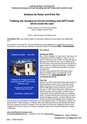
Andrées de Ruiter and Prem Rai Trekking the Annapurna C ircuit including new NATT – trails which avoid the road ISBN: 9783844800364 Andrées de Ruiter and Prem Rai Trekking the Annapurna Circuit including new NATT – trails which avoid the road A guide book to one of the finest trekking areas of Nepal and the world NATT = New Annapurna Trekking Trail This Edition 2011 was written based on information gathered during August and September 2011 Free version on the internet. This text will also soon be published as a paperback much more convenient to carry with you at Books on Demand GmbH, Norderstedt ISBN: 9783844800364 Th e authors Andrées de Ruiter Born 1956 in Belgium he lives now in Germany. He travelled the first time to Nepal in 1981 on a nine month overland journey to Asia. His first trek was to Manang. Since then he has come to Nepal some 30 more times. His favourite area i s the Annapurna region which he visited several times. Andrées de Ruiter works as a freelance consultant for quality management. He has a large website with information about different trekking areas and especially of the Annapurna area : www.nepal – dia.de , email: namaste@nepal – dia.de . Prem Rai Was born in1975 at the little hamlet called Sintup of Sankhuwashaba district in the north part of east Nepal, he grew up in a f armer family. He moved with his Wife Maina and son Shyam to north of Pokhara in 1997 and to Pokhara in 1999 when he started working as Porterguide. In 2004 he had received the Governmental license as a trekking guide. He does trekking with tourists but as well is organising bigger groups in various trekking areas. He has a profound knowledge of the Annapurna area as he is very interested in finding trails out of the beaten tracks. It is his Idea to call the new trail grid NATT: New Annapurna Trekking Trails . He made several tours with Andrées de Ruiter. Prem will continue to monitor changes in the new trails so that we can update the book in time. Together with his wife, they are running a massage therapy centre named fiStairway to Heaven fiin Pokhara www.trekwithpremrai.blogspot.com/ premmainarai@hotmail.com , Facebook: Prem Rai, www.facebook.com/prem.r ai2
PAGE – 2 ============
Andrées de Ruiter and Prem Rai Trekking the Annapurna Circuit including new NATT – trails which avoid the road ISBN: 9783844800364 2 First edition October 2011 The authors .. . 1 Foreword: .. . 3 Paint ing the Himalayas .. .. 4 The marks: .. .. 4 Status August 2011 .. . 4 General fa cts about trekking .. 5 Cigarettes & Co .. . 6 In Kathmandu: .. 7 Getting t o the Annapurna area: . 7 Trail description with NATT trails . 8 Possible schedules .. .. 8 The need for a good altitude acclimatization .. 9 From Besisahar to Bhulbhule .. .. 9 Bhulbhule .. . 9 Bhulbhule – Bahundanda .. . 10 Ghermu .. .. 10 Syange – Jagat .. .. 10 Jagat Œ Chamje .. .. 11 Tal .. .. .. 11 Tal to Dharapani .. . 11 Bagarchhap – Danaque Œ Temang . 12 Thanchouk Œ Koto Œ Chame .. . 12 Chame – Bhratang .. . 12 Bhratang – Dhukur Pokhari .. 13 Upper Pisang** 3400m .. 13 Ghyaru ** .. 14 Ngawal ** 3660m .. 14 Braka *** (Braga) 3470 m .. .. 15 Side trips from Braka .. 16 Ice Lake ** .. . 16 Milarepas™ Cave ** .. . 16 Manang * 3500 m .. .. 16 Day hikes from Manang: .. . 17 Side Trek to Khangsar and Tilicho Lake 17 Manang to Khangsar 2 hours .. 18 The fiGrande Barrierefl *** .. .. 18 Going to Tilicho Lake *** .. . 18 Crossin g Tilicho Lake to Jomsom . 19 Manang to Yak Kharka or Churi Ledar 19 Crossing Thorong La and the dangers of High Altitude Sickness 20 Churi Ledar to Thorong Phedi . 21 Climbing up to High Camp .. . 22 From high camp to Thorong la 3 – 4 hours .. 22 Thorong La to Muktinath 4 – 5hours 22 Muktinath *** .. . 23 Ranipauwa ~3770 m .. . 24 Jharkot ** .. 25 Lubra ** (also Lupra) .. . 26 Lubra to Jomsom 2 hours .. .. 26
PAGE – 3 ============
Andrées de Ruiter and Prem Rai Trekking the Annapurna Circuit including new NATT – trails which avoid the road ISBN: 9783844800364 3 Muktinath – Ranipauwa to Kagbeni *** . 26 Chongur ** .. . 27 Jhong ** (also Dzong) .. .. 27 Jhong ** to Putak* .. . 27 My love Kagbeni 2800m .. . 28 Tiri 2800 m .. 29 Kagbeni – Jomsom standard route 2, 5 hrs .. 30 High route from Ka gbeni to Jomsom ** .. 30 Jomsom 2720 m .. . 30 Jomsom to Marpha by road 1 – 1, 5 hrs 31 Jomsom to Marpha by the new NATT – trail .. 31 Marpha *** .. . 32 Marpha – (Tukuche) – Kokhethanti 32 Tukuche .. .. 33 Chokhopani to Sauru (2 – 2,5 hrs) 33 Sauru to Sirkung and Kokhethanti 33 Kokhethanti – Titi Lake, Taglung – Kalopani . 33 Kalopani .. . 34 The fore st trail from Lete to Ghasa ** .. 35 Ghasa 2010m .. .. 35 Dana .. .. .. 36 Tatopan i Œ Pokhara by Bus or Jeep . 36 From Tatopani to Ghorepani and Poon hill *** 37 Ghorepani 2860 m .. . 37 Poon hill *** .. .. 37 Tadapani Œ Gandrung Œ Birethanti – Nayapul .. 37 Pokhara *** 800 m .. . 38 What to do in Pokhara? .. .. 38 Continuing from Pokhara: .. .. 39 Foreword: Once upon a time the Annapurna Circuit w as one of the most beautiful trekking areas of Nepal. Then in a general national plan for developing Nepal a large programme of road building was started with the goal that every district head quarter was connected by road. The department of road started t o plan roads to Manang and Jomsom. As Nepali people use to walk in the mountains only for visiting relatives or make some business they don™t mind at all to walk along streets as it is faster and easier. Therefore no one of the responsible realy realised that trekkers have a completely different view how a trekking trail should be and that no trekking tourist would like to walk on a dusty road chased by horning trucks and motorcycles. Quite a few lodge owners foresaw the problems, but there was a strong l obby of villagers who saw many advantages. In fact a road means a better possibility to sell theirs own farm products like apples, thus earning more, and in the same time other goods brought by the road are much cheaper than carried by mule or porter. Thi s results in a higher life standard. Also travelling is much easier And so the road construction started but no one cared to plan already alternative trekking trails. I t was only when the road between Beni and Muktinath was finished that the highly negativ e impact on trekking tourism was understood. In 2010 many tour operators in Europe had stopped treks in the Jomsom area and in the Internet many individual trekkers said that it is no more fun to trek down the road and suggested just to take the bus after Jomsom or even directly jump into a jeep in Muktinath/Ranipauwa In 2006 ACAP started planning a full alternative trekking trail avoiding the road and they are busy making new trails. We call them New Annapurna Trekking Trails = NATT. There is more and more a complete grid so that one can not only make the classical Annapurna circuit but also enjoy
PAGE – 4 ============
Andrées de Ruiter and Prem Rai Trekking the Annapurna Circuit including new NATT – trails which avoid the road ISBN: 9783844800364 4 many side trips. Both the Manang and the Jomsom side can be visited in a marvellous trekking experience just on there own without crossing Thorong La. Why this b ook is published in book on demands When I looked to the books on Annapurna area it appeared that they were all absolutely outdated, most being printed in 2009. A printed book will always take more than half a year only for printing preparation and then th e publishers want to sell first the remaining stock before making a new edition. When in August 2011 I explored the new trails in the Annapurna region I realised that it is very important that this information will be available very soon to the trekkers (i f possible in October 2011). This is only possible with the system of books on demand, where only a file is stored and then the books are printed one by one only if someone orders one. The main advantage is that there is absolutely no stock and that one ca n change easily the file. If there is enough demand this book will be probably updated at least twice a year based on the information Prem Rai is collecting from the field. So see this edition as a first quick and roughly start just giving you the informat ion to explore all these new and beautiful NATT treks. So please excuse the many tipping and language errors. I hope that even with them this little book will help you to experience beautiful new trails you would have missed without it. Painting the Himala yas With my Nepali Partner Prem Rai I visited the Jomsom trek in December 2010 and we could walk nearly all the way to Tatopani along the separate pure trekking trail. I was very pleased but we had quite often problems finding the right trail at various ju nctions. Therefore we approached ACAP in Pokhara and I explained the system of marking trekking trails in the European Alps by painting rocks or trees on the way. This is a much easier, much more economical and efficient way than only putting signposts. We proposed to use red/white marks for the main AC trail and blue/white marks for side trails. ACAP liked this suggestion and so Prem Rai and I started in August 2011 with 5 litres of enamel in Besisahar. In the Kali Gandaki valley we were joined by the Joms om ACAP staff members Mr. Rishi Ram Dhakal and after two day by Mr. Bel Bahadur Pun and the Guide Mr. Hari Nepali. The marks: In addition to the signposts we marked the trail by painting marks on rocks, electric poles houses and sometime trees. As long as the trail is obvious we did not mark when the trail is following the road. Some times we had to add some arrows to explain the route, but often you just have to look a little bit around on a junction and you will see the next sign. We all from the Himalay a Painting Team hope that, it will make easier for trekkers to follow these sometime little trails. Status August 2011 Manang side: Actually just a part of the road on the Marsyangdi side (Manang trek) is in use, the buses from Kathmandu and Dumre ride t ill Bhulbhule, in the dry season Jeeps continue to Syange or sometimes up to Jagat. There is heavy blasting works on the cliffs opposite Tal and it will take several months before a vehicle can pass this difficult stretch. After the clif fs the road is rea dy till Danaqi u. There the road is still under construction with heavy blasting and road works high above the river going to Temang. Because of the blasting and rocks falling down from the road all the area below is still closed and the people of Latamaran g have been evacuated. The road is finished till Chame and then partially till Manang. As there is no get through before Tal there is no traffic above Jagat except road constructing machines and tractors. Jomsom side: There is a gravel road which connects Beni to Muktinath and upper Mustang.
PAGE – 5 ============
Andrées de Ruiter and Prem Rai Trekking the Annapurna Circuit including new NATT – trails which avoid the road ISBN: 9783844800364 5 In the winter season several buses a day ride up to Jomsom. From there Jeeps make the connection up to Muktinath Ranipauwa, carrying hundreds of Indian pilgrims to the temple area. As most of them just arrived in the m orning, the high altitude is hard and many of the elder pilgrims will gladly ride back to the jeep parking place on a motorcycle. Fortunately there is now the possibility to trek all the way down to Tatopani avoiding nearly completely the road. So please f orget everything like it is not worth anymore to trek down to Tatopani. The Jomsom trek is again one of the best trekking areas of the World General facts about trekking Trekking Seasons: Fall: this is the most popular trekking season starting from Octo ber to the mid of December. The monsoon stops around Begin to Mid of October. But be careful, often there is still many das of rain in the first half of October so I would suggest not to start before the 15th of October. Most o f the times the sky will be v ery clear with good mountain views. In October the fields and pastures are still green. October is still warm and sometimes people cross Thorong la in shorts. But be prepared that in the mountains it can always be suddenly very cold. I once had even snow j ust above Manang in October! In November the weather is getting much colder but the mountains views are crystal clear. Mid. November to mid. December is usually a very dry season. In the second half of December winter storms coming from the north can bri ng snow and rain. In November I always have a very warm sleeping bag and a cosy down jacket with me. Winter: Mid December to end of February. This is the very cold season with temperatures going down sometimes below – 20° C on Thorong la and sometimes fre ezing temperatures in the sleeping rooms of the lodges. Definitively a down jacket will make you trek much nicer, as most of the lodges will not be realy heated. Even in winter, most of the time a small foot spoor will be made by trekkers so that one can c ross Thorong la. But it may be not possible for several days after a snow period. Spring: March to June. This is a very nice season, with rhododendrons trees flourishing around Ghorepani. You will see many flowers. The weather is mostly clear in the morn ing but soon getting dizzy. The later you are in spring the sooner clouds will mask the mountains. Expect to have regularly some rain showers during the day. An umbrella is a must during this season. Monsoo n: July to begin of October. I have trekked twic e in monsoon season and it was both times very nice. In August 2011 I used during 23 trekking days my umbrella only for 10 hours! You will rarely see any mountain, just sometimes for a few minutes as the summits are nearly always in the clouds. But there w ill be enough sun to get bad sunburn! You will see many beautiful flowers and colourful butterflies for people who have visited the area before so that they know the Mountain View, Monsoon is a very interesting and rewarding trekking season. An umbrella is a must as you would be boiled wearing a closed rain coat. Lodges There is a long tradition of Nepali people trekking in the Himalaya as it is very common that people visit their parents or relatives on various festivities. AS the first roads were built i n the 70ties it was and is just normal that people will walk for days. To give them food and shelter many families opened a little tea shop along the trails. There one could get tea, dal bhat and in the nig ht one could sleep on the floor or sometime some b eds where available. When I first went to Manang in 1981. In Manang these Teahouses were the standard and in remote trekking areas you will still find and use them. The tradition of the teahouse was that you only had to pay for the food. For this reason t he price for an accommodation is still very low. But lodges will ask you not to eat in another place or to pa y a much higher accommodation price. Soon the standard started much to improve and on the
PAGE – 6 ============
Andrées de Ruiter and Prem Rai Trekking the Annapurna Circuit including new NATT – trails which avoid the road ISBN: 9783844800364 6 Annapurna circuit the lodges an excellent. Normally you w ill have a small room with two beds and just a small place to put your bag pack. Often the walls between the rooms are just made of wooden planks. You will get a padlock from the lodge if you don™t have your own one. You should bring your own sleeping bag with you, even when most lodges will provide some extra blankets. But it is much more hygienic to have just your own bag to avoid getting free bed bugs ; – ). On the AC there is normally never a problem to find a lodge to sleep sometimes you will not get th e one you where looking at but you will get always sleeping place. As the general standard is rather similar, I don™t recommend in general any lodges like Lonely planet does. First I could not check them all and my experience is that rarely the recommended are really better than other ones but much more crowded. And it is not just for the other lodges which should have an equal chance. For me the most important criterion to choose a lodge is the smile of the didi. If I like it I will be probably happy for t he rest of the evening. Food and drinks There is a reason that parts of the Annapurna circuit are called apple pie trek. And fact the food i s generally excellent. You will find a menu card with classical food like dal bhat (rice with lentil s oup and curry vegetables) and many other items like pasta. More and more you will find also meat on the menu card. The choice for breakfast is also copious from muesli or porridge to chapati and eggs any style. Tibetan bread is fried and delicious. If you are travellin g with porters or Nepali guides, they will want to have a dal bhat around 11 – 12 AM. Be aware that it may take 1, 5 hours to prepare it. Better have a noodle soup or fried noodles for lunch as it will be ready much faster. There is a large choice of drinks: various teas, coffee and cold drinks. On the upper part of the AC in the Buddhist areas ask for fisuchiafl , the Tibetan style salted butter tea. Don™t expect a tea but rather a sort of soup or bouillon . It definitively worth the try! An other speciality of this area is the sea buckthorn juice. You will pass many of the little bushes. The berries are collected and syrup made of them. Surprisingly the prices are lower on the Jomsom side, even when the syrup is carried over Thorong la. You might just buy a bot tle of syrup and mix your own juice. On many places of the Annapurna circuit you will find safe water drinking station. This water is purified and disinfected and much cheaper than the bottled one. This water is safe. Bring you own bottle to be filled. Ci garettes & Co You can buy cigarettes, toilet paper or chocolate bars in every lodge, so there is no need to bring it all along the way. Money: You will need Nepali Rupees on the trek. Even when sometimes it was possible to get money with a credit card in Jomsom or Marpha I would never relay on this possibility as it is often not possible. So this means have cash with you. You can change traveller cheques or foreign currency at various places on the AC. But in the lodges they will ask you NPR. The best plac e for change is Kathmandu where you can either change in a bank or with private money changers. In Thamel the bank near fire and Ice offers sometime better rates then the private money changers. Also the money changer in Freakstreet has better rate then Th amel money changers. There are also many ATM in Kathmandu and Pokhara giving Cash on credit cards. In 2011 no ATM in Pokhara was giving me Cash on my EC Card with Maestro system. I™m carrying all my money in a money belt. Life is getting more and more expe nsive in Nepal. Count at least 20 Euro/30 USD per day. If you don™t spent all the money during the trek you will need it anyway afterwards easily in Pokhara and Kathmandu. But it is realy bad running out of money during the trek. If you like to drink some beer be aware that a bottle will be around 300 – 350 NPR which could increase much your expenses. Arriving in Nepal V isa: Your passport must be valid up to 6 months after you planned departure from Nepal. You can get a 30 or 100 Day visa directly at the air port. If you want to extent it, you have to go to immigration office in Kathmandu or Pokhara. There is no possibility to extent a visa in a trekking area.
PAGE – 8 ============
Andrées de Ruiter and Prem Rai Trekking the Annapurna Circuit including new NATT – trails which avoid the road ISBN: 9783844800364 8 Trail description with NATT trails Riversides: The riversides are always defined looking from the source down the river. Lodges: The classical lodge is rather basic but the standard in the Annapurna area is rather high. Normally you will get a small room, just enough to put two little beds and space for your bag packs. Often the rooms are on the first floor and the wall is just made of wooden planks. The rent is still very cheap but you are expected to eat at the lodge, in the past there was a long tradition of Teahouses offering food for travellers. In the night people could sleep on the floor for free. If yo u decide to eat in an other lodge your lodge might ask you to pay a much higher rent. Possible schedules Day Normal Fast gear 1 Kathman du – Bhulb h ule Kathmandu – Syange 2 Bhulb h ule – Bahundanda – Ghermu Syange Œ Tal – Dharapani 3 Ghermu – Chamje – Tal Dharapani – Chame 4 Tal – Dharapani – Temang – Chame Chame Œ Upper Pisang – Gyaru 5 Chame – upper Pisang – Gyaru Gyaru – Ngawal – Braka – Manang 6 Gyaru – Ngwal – Br aka Rest day in Manang or Khangsar 7 Daytrip to Ice lake or Milarepas cave , Manang Manang/Khangsar to Yak Kharka or Churi Ledar 8 Rest day in Manang or Khangsar To Thorong Phedi or high Camp 9 Manang/Khangsar to Yak Kharka or Churi Ledar Cross Thorong la to Muktinath 10 To Thorong Phedi or high Camp Muktinath – Lubra – Jomsom – Marpha 12 Cross Thorong la to Muktinath Marpha – Kokkethati 13 Muktinath to Kagbeni Kokkethati – Dana 14 Kagbeni to Marpha Dana Œ Tatopani (2,5 hours) + hot springs 15 Marpha to Koket hati Tatopani – Ghorepani 16 Kokethati to Ghasa Ghorepani Œ Poon hill – Tirkedunga 17 Ghasa to Dana or Tatopani Tirkedunga Œ Nayapul – Taxi to Pokhara 18 Rest day in Tatopani & hot springs 19 Tatopani – Ghorepani 20 Ghorepani Œ Poon hill – Ulleri 21 Ulleri – Nayapul Œ Bus to Pokhara
PAGE – 9 ============
Andrées de Ruiter and Prem Rai Trekking the Annapurna Circuit including new NATT – trails which avoid the road ISBN: 9783844800364 9 The need for a good altitude a cclimatization I t is absolutely necessary that you stay at least two or better three night in the upper Manang valley before you continue to go further up to yak Kharka or Churi Ledar. Possible plac es are Gyaru, Ngawal, Braka, Manang and Khangsar Trekking from Begnas Tal This is a beautiful Trek which is taking by very few tourists. Therefore the lodges are very simple. But I liked it so much that I have taken it already three times. Take an early mi nibus from opposite the old bus park in Pokhara to Begnas Tal. In Begnas Tal take either the trail up to the ridge which offers beautiful views on the Annapurna range above the lake. Most people will take the bus to Karputar. From Karputar go to Syauli Baz ar. There is one lodge in Bavarian style! Continue to the east cross the river and climb up a very steep hill to finally come to the beautiful village of Nalma. Continue along the ridge to reach the village of Baglungpani with on very basic lodge but a fan tastic Dal Bhat. You will come once to a branch Œ off the trail, keep on the left side. Don™t miss in Baglungpani the sunset with a great panorama of Annapurna and Manaslu range from the ridge above the village. Continue from Baglungpani to the west and des cent to the Marsyangdi valley and you will reach Khudi, which is not far away from Bhulbhule. From Besisahar to Bhulbhule There is still a check post in Besisahar but most busses just drive without stopping there Besisahar – Bhulbhule by side trek 4 hours, 200 m climbing, 165m going down There is a very rewarding side trek through beautiful rice paddy fields from Besisahar to Bhulbhule bypassing most of the road. It is definitively a very nice alternative to a bumpy bus ride and many people who did it enjoye d it much. For me Nepal is not only the high mountain areas but as much I love the lower regions which I never would like to miss! When you are at the end of Besisahar where the road plunges down to the river you can take on the right hand a little shortcu t trail leading directly to the river which you can cross on a little wooden bridge. After reaching the road you follow it for approximately for 30 min. On the way, you can already see the suspension bridge going over the Marsyangdi River. Between a few ro ad shops the trail starts to the right, watch for the red white signs. Soon you will reach the bridge and cross the river. On the left the trail is going up through the villages of Lete, Mulbazar and Simalchaur. Simalchaur named from the Simal tree, which flowers in spring with big red flowers. From there you still have to climb a lot to reach the highest point at 1030 m (200m above Besisahar) On the way down you pass some houses and have a beautiful view on the Marsyangdi valley and the Manaslu range and y ou reach Bhulbhule passing a nice little Buddhist Stupa. You reach Bhulbhule, where people coming by bus will join you crossing the Marsyangdi on a long suspension bridge. Bhulbhule This is actually the last bus. There are now lodges on the right (road) r iverside and also the ACAP check post. You can continue with a jeep till Syange or even maybe to Jagat. The traditional trekking trail is on the left riverside and you cross the Marsyangdi River on a long suspension bridge. On my first treks I was very afr aid crossing suspension bridges. On the way to Jomsom I nearly could not pass the bridge near Lete. Later I met two Australian girls and we came back together. Already two days before Lete I started to be nervous. And then I was puzzled as the girls were l ooking forward to pass this awful bridge, saying it is great fun! Ok. So I had to try to have a different psychological approach and crossed it first without my backpack and whistling a little tune. And it worked!!!! Since then I like crossing suspension b ridges. Don™t be to
PAGE – 10 ============
Andrées de Ruiter and Prem Rai Trekking the Annapurna Circuit including new NATT – trails which avoid the road ISBN: 9783844800364 10 stiff when crossing, it is like dancing with a partner you have to follow the movements to enjoy it. Feel the swing of the bridge when you make it actively moving and you will love it! On the left river side there are several lodges, mo st of them in the classic basic but perfect style. It™s a wonderful place to pass the first evening listening to the sound of the river. Bhulbhule – Bahundanda 4 h Start from Bhulbhule on the main trail which is easy to follow. It™s not such a bad idea to continue from Bhulbhule the same afternoon if you have some hours left as you will be earlier climbing up the step hill of Bahundanda the next morning. Surrounded by green paddy fields you will pass along many nice garden lodges. First you will reach the little villages of Ngadi bazaar and then of Ngadi, where you cross on a huge suspension bride over the Ngadi Khola a side river of the Marsyangdi Khola. Continuing on the trail you will join again the road. When the road dips to the river and you can alrea dy see the bridge, on which the road crosses again the Marsyangdi to reach Syange, you turn sharply to the right and take the road going up. This road is constructed for a hydropower project further up. Instead of taking the side road to the right you just continue straight seeing already the houses of Bahundanda which are above a high ridge. You will have to climb this ridge, and in whatever month you will do it you will sweat a lot! So try to be there early in the morning, before the sun is heating up the south slopes like an oven. And you probably will get hallucinations of cold coke while climbing ; – ). But once you are on the top you will be in a nice village with rewarding views. It is on 1310m and has 5 old style basic lodges and 2 newer which are a li ttle bit above the village. Most people like very much Bahundanda and it is a perfect place for lunch. Bahundanda to Germu /Synge 2 – 2.5 hours After Bahundanda you will descent on a very steep trail with some stairs, which can be very slippery when it is raining. You reach again flat paddy fields and then the trail is going more or less on the same level through fields and forests and often high above the river. Finally you will reach Ghermu phant (plain land) with lodges stretched over more than 2 km. It is a pleasant place to relax in the afternoon as Ghermu is rather sunny. Ghermu You can ask in the last lodge in Ghermu, the rainbow lodge, if there is already a trail to the second bridge on the way to Jagat. The landlord was thinking to improve and conn ect some little paths to a trail which would avoid another half hour walking on the road. Alternative High route from Ghermu: There is a possibility to avoid the road till Jagat by climbing up around 150 m to the villages Tallo Chipla and Mathilo Chipla. Then the trail will descend to the river which you can cross directly below Jagat, This route will take around 3 – 4 hours. I haven™t tried it yet but it looks very promising and would be also a very good exercise for your legs. At the end of Ghermu desce nt to the river and cross on a long suspension bridge to Syange. There are 5 lodges in Syange. One newer is a little further on the left near a huge waterfall but on the road. The road fortunately bypasses Syange from above but still one will hear every je ep. If you came by jeep and want to stay I suggest that you cross to Ghermu. It is just 15 Œ 20 min. away and much quieter and sunnier. There might be Jeeps riding from Syange further up to Jagat. Syange – Jagat 2, 5 hrs follow the new road to reach in 25 min the settlement of Chirchaur with to new lodges, both directly on the road. They advertise hot springs in 5 min, but one has to walk about 10 min, cross the river and it is just hot water coming from a tube without a pool. There are plans to build a pro per pool on this side of the river bringing in the water by piping. The road later climbs in serpentines to Jagat. You may try short cuts but beware of falling rocks. You will pass a little house perched right on the side the trail like an eagle nest. Dur ing the civil war it was occupied by maobadis who had from here a perfect control of all the people coming up. From here you can already see the village of Jagat.
PAGE – 11 ============
Andrées de Ruiter and Prem Rai Trekking the Annapurna Circuit including new NATT – trails which avoid the road ISBN: 9783844800364 11 Jagat (1300m) has a community mainly of Tamang and Gurung. There are many lodges and restaura nts. Actually the roads end up here. It is not clear if the road will later bypass Jagat or just go right through it. This would make it a very unpleasant place to stay. Jagat Œ Chamje 2 – 2, 5 hours: After Jagat the road begins again going to Chamje. Fol low it till you reach the two teahouses of Ghatte Khola. When you passed the last one climb up the hill to the left on a NATT – trail marked with red/white signs. This is the old scenic trekking trail leading through a beautiful and romantic forest. You fir st have to climb some 130 m till the trail is getting nearly flat and you reach the Rainbow Waterfall Hotel , which got his name from the big waterfall just opposite on the other riverside. One other reason to take this trail is that by being higher above the river it is much quieter so that you can understand you companions without shouting all the time The Rainbow Waterfall Hotel is already on the same height than Chamje so finally the real difference in climbing for the two ways is less than 30 m. Ent ering upper Chamje after few minutes you will find 3 lodges which are much quieter than the ones right inside the village. If you want to stay in Chamje the upper part it is definitively the better choice From Upper Chamje you have to step down a small pat h to the road and you are at the entrance of main Chamje. Here you will find some more lodges. Probably the road will soon pass straight through the lower part of Chamje, Going AC clockwise: Chamje to Jagat just after the end of Chamje watch out for a litt le path on the right side going up and marked with the NATT red/white signs. It is the scenic old trail leading to Jagat. Chamje to Tal: 3 – 4 hours Just after Chamje, the construction of the road continues, going to the left hill. Turn right and descend a very step path, marked with red/white NATT signs going down to the river and cross it on a suspension bridge. After the bridge follow the trail passing a great waterfall. After 1:30 hour you will reach the two teashops and the houses of Sattale (1525) Th e Thorong Peak Hotel offers 6 double basic rooms. It might be a good choice to go there, if you have enough time left in Chamje, as you can start the climb to Tal early in the cooler morning. After some going up a down you reach the step climb to Tal, whic h has been formed by an enormous landslide blocking the whole valley like a dam. On the top you look down to the village of Tal with the waters of the normally very wild Marsyangdi being pond so that they flow just slow and gently. Most of the time, you ca n descent straight down to the river on the normal trail. Sometimes this way is over flooded and you must take the high route, which was build when a big rock fall destroyed the old path along the river some years ago, the water coming till the cliffs. Tal Tal is a beautiful village, mainly lodges, but also some old houses. Here the valley widens and it is a very pleasant spot ideal for lunch or overnight stay. Behind the village is a huge waterfall which makes nice photos together with the horses, Tal is f amous for. Fortunately the road will stay on the opposite riverside and not go through Tal, as some Nepali maps show. Tal to Dharapani Continue the trail along the river, after 25 min you reach 3 little garden lodges in Sirantal. All along on the other riverside one can see workers digging and blasting the new road out of the rock cliffs. Be careful, when they blast, small rocks hit your trail! But it is very interesting to watch all the people. At the end of the narrow gorge you climb up a little bit t o go down again to a bridge and cross to the other riverside where you can walk on another stretch of the road. The plan is, that in December 2011/January 2012 a new trail will be completed going all the way from Tal to Dharapani on the eastern side, compl etely avoiding the road. This seems to be possible as there are the remains of an old trail existing. In this case you could continue instead of crossing the river.
217 KB – 39 Pages